


Certification
Partner
Copyright © 2021 by CheckinTravel
![]()
Son La is a mountainous province located in the Northwest of Vietnam between 20039 "- 22002" North latitude and 103011 "- 105002" East longitude.
Son La province has 12 ethnic groups living together, of which the Thai make up 54%, the Kinh 18%, the Mong 12%, the Muong 8.4%, the Dao 2.5%, and The other ethnic groups are: Kho Mu, Xinh Mun; Khang, La Ha, Lao, Tay and Hoa.
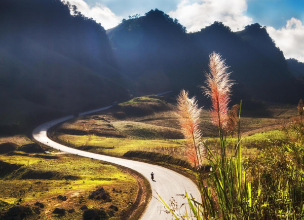
Son La's topography is divided into regions with different ecological characteristics. Son La has two plateaus: Moc Chau and Na San. Moc Chau Plateau has an average altitude of 1,050 m above sea level, characterized by a subtropical climate, fertile soil, favorable for tea, fruit trees and dairy farming. . Na San Plateau has an average altitude of 800 m, running along the axis of National Highway 6, fertile land favorable for the development of sugarcane, coffee, mulberry, mango, longan, pineapple ...
Son La has a tropical monsoon climate in the mountains, cold and dry winters, hot, humid summers, and a lot of rain. The topography is strongly and deeply divided, forming many sub-regions, allowing the development of a rich agro-forestry production. Moc Chau Plateau is very suitable for plants and animals in temperate regions. The area along the Da River is suitable for tropical forests all year round.
Son La climate is divided into two distinct seasons, the dry season and the rainy season. Average annual temperature is 21.40C (average monthly highest 270C, lowest month 160C). The average annual rainfall is 1,200 - 1,600 mm, the average humidity is 81%.
Thoughtful thoughts to your inbox
Copyright © 2021 by CheckinTravel
![]()
